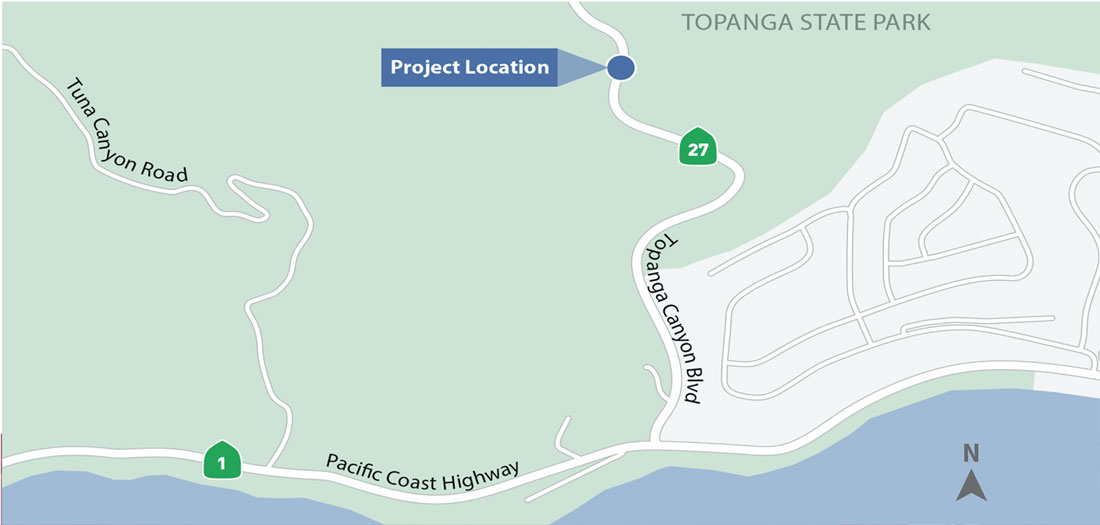
The California Department of Transportation (Caltrans) has been studying and is preparing for a rockfall mitigation project on State Route 27 (Topanga Canyon Blvd.), next month, from postmile 1.0 to approximately postmile 1.13, in lower Topanga Canyon between the City of Malibu and the Community of Topanga, within Topanga State Park (e.g., the S-Curves).
A public scoping meeting/webinar will be held live on Tuesday, January 11, 2022, from 6:30-8:30 p.m., via Zoom to provide an overview of the project, summary of the environmental process, and receive input regarding environmental issues and the suggested scope and content of the Environmental Impact Report (EIR). This meeting/webinar will include the required agency and public scoping. The goal is to stabilize the slope above to prevent rocks from falling onto the roadway, blocking the road, and potentially injuring motorists. The existing environment and impacts to the existing environment are factors in the decision-making process, as well as selection of a preferred alternative. For more information: sr27topangacanyon.com.
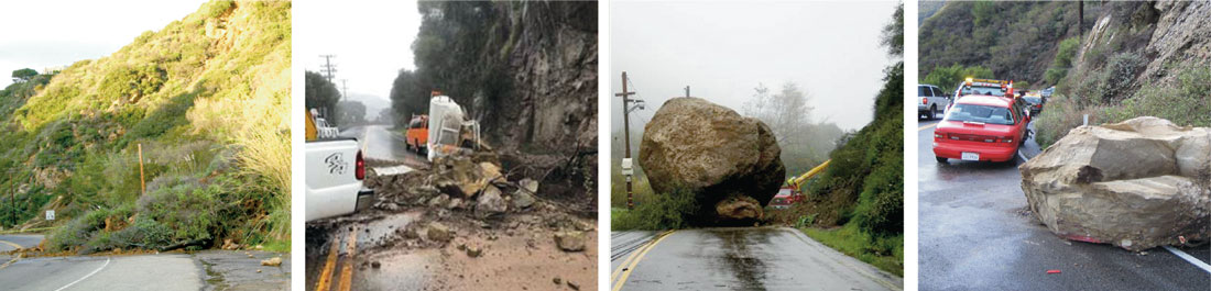
Various alternatives will be studied to prevent rocks and boulders from falling onto the roadway and potentially injuring motorists. There have been various documented instances of rockfall and slides onto the roadway. Caltrans is the lead agency under the National Environmental Policy Act (NEPA), and also the lead agency under the California Environmental Quality Act (CEQA)
SAVE THE DATE AND REGISTER NOW—Scoping meeting/webinar Tuesday, January 11, 2022, 6:30 to 8:30 p.m.
Registration link: https://us06web.zoom.us/webinar/register/WN_N-1P71zwTHKQqQsc8MMtlw
Webinar link: https://us06web.zoom.us/s/84355170114?pwd=TlRWVEJtM3hpK0t0L3hQbmlhb25oUT09
Webinar ID: 843 5517 0114
Passcode: 5851
Phone: (669) 900-6833
Photos Courtesy of Caltrans
Above: Images of rockfall incidents along SR-27 in the project area between 2010-2018. Below: Project Area Map.